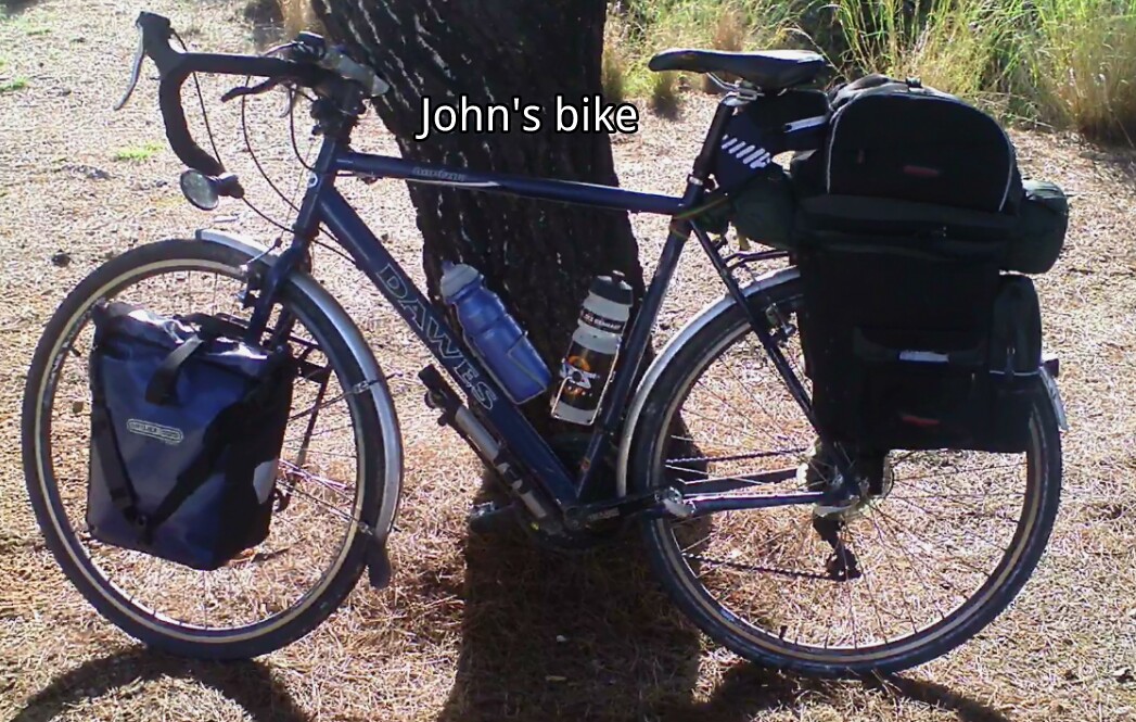
As it turned out John's bike again stood up to the tour very well. All the main components performed very well and much better than I would have expected. Surprisingly he had no spoke breakages and the wheels are still true. This may well be because he does not have the very low gears which put a real strain on the bike in the mountains. Walking up the steeper bits may have saved breakages though did nothing for John's well being.
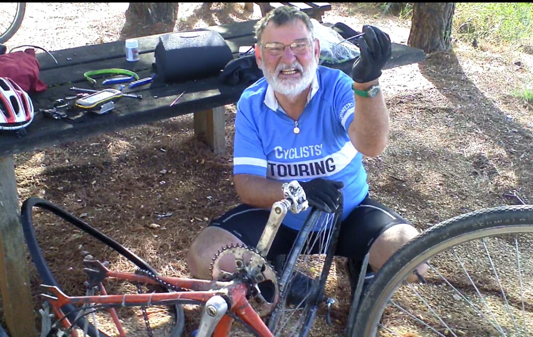
Tyres and carriers are areas where cycle tourists cannot afford to compromise. Again this year John had a problem with his front carrier. We easily fixed it but it almost certainly would not have happened if he had used a Tubus carrier.
His luggage choice was interesting. He very sensibly used Ortlieb waterproof roll top classic panniers for everything he needed to keep dry. He carried these on the front carrier and as you would expect they performed faultlessly. His rear panniers were of the throw over kind connected in the middle. They are not waterproof and have long been out of fashion. They have the interesting and very useful feature of a small rucksack which is attached, I think by zips, to the top of the panniers. This can be quickly removed and used as a back pack for shopping and carrying valuables. I would guess his rear luggage will be in the bin years before the Ortlieb's give up. On the other hand the rear luggage was not expensive and did the job John wanted them to do well.
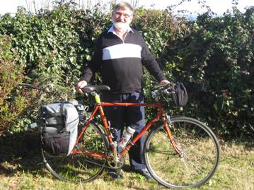
Having travelled with John I do feel that the best option for expedition touring is the perceived wisdom of the cycling community. At least if you start with good quality reliable equipment there is less chance of things going wrong. The cost of the bike and equipment is not the major cost of an expedition of this type. Compromising on bike and equipment or even taking a risk on it being alright is just not worth it. Breakdowns are always very inconvenient and often expensive. The cost of replacing things like tyres and carriers to bring a bike up to a higher standard is also high. And that comes from somebody stupid enough to take a thirty year old time trialling bike on tour.
John asked me to plan our route from Belgrade to Lefkada. It was restricted by Foreign Office warnings on safety which unlike many travellers I took notice of. The original route via Serbia, Kosovo and Macedonia was ruled out. Kosovo was having another fall out with Serbia. The other problem was that there were armed gangs in the remote Macedonian mountains and areas where landmines had still not been cleared. Motorists can go this way but it involves motorways and the only good cycle routes went straight through the danger areas.
I updated my Garmin map of Europe at a cost to which I object. The mapping for Serbia, Montenegro and Greece was accurate for most of the roads we used but only covered the main road network in Albania. I doubt if there are any current maps of all roads in Albania because new roads and changes to old roads are happening so quickly.
The route I chose proved to be great for us and talking to other cyclists we did well to avoid the coast in Montenegro which is extremely busy. The high points were the mountains in Serbia, Montenegro and Albania with Albania being the most spectacular.
I was forced to use Garmin's very unpleasant BaseCamp program to draw my track of the route onto the map. This is because Garmin are so restrictive about loading their maps onto a computer. The web alternatives are getting better everyday and are well worth exploring.
I then had a complete route as tracks in Garmin MapSource format. I split these tracks into reasonable length day rides. I then downloaded them onto my Garmin Montana and backed them up onto my Acer 10 inch netbook, see below under communications.
 |
The Montana GPS
|
Route Planning
Navigation
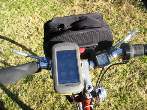
Navigation on the rides could not have been more simple. I had the Garmin Montana on my handlebars and followed the track on the map screen. I had the destination marked as a waypoint just to be on the safe side. We only got into real map navigation when we varied the route or failed to trust the instrument.
It is true that using the GPS this way deskills navigation. Once there is any deviation between the track on the GPS and the position arrow we had gone wrong. We seldom went more than 50 metres in the wrong direction unless we went a different way on purpose. We also had the saving grace that John, unlike many cyclists, likes to know where he is. He always had his 200,000 scale map on his handlebars so we did have an overview.
Communications, computers and GPS
Mobile phone companies still rip you off at 30p a minute for calls made abroad. It can cost �300 a week to use a Google Android or an iPhone outside the UK mainland. I turned 3G off, only using 2G. I also used an App to ensure that everything else was off. We used texts where this was appropriate and kept calls to a minimum. John used internet cafes to update his blog and it is also possible to make Skype calls from most internet cafes.
New for this year I treated myself to a Garmin Montana GPS. It is extremely powerful and enables a cyclist to view the local area while riding almost as well as with a conventional map. Unfortunately Garmin do not think it will be used on bicycles and so do not make a suitable handlebar mount. I improvised my own as can be seen from the picture.
I used my Acer 10 inch netbook for almost everything. It runs under Windows XP which if you have to use Microsoft still works better than Windows 7. Where wifi, often called wiffy in non English speaking countries, is available it is possible to surf the net, listen to BBC radio live, send and receive emails and make Skype calls. I also use a Kindle as a book reader and to get a web connection free on 3G when wifi is not available.
 |
The Acer
|
Unfortunately this arrangement means carrying more equipment than I would like but we found it worth the extra weight. It was especially useful for planning changes to the route. It order to avoid damage in the pannier I carried it and the Kindle in a neoprene case inside a plastic box inside a waterproof bag.
Before my next tour I will be experimenting with a tablet computer to try to reduce the size and weight of the electronics. I have ditched the psixpd used on my previous tour. It was far from ideal but the best I could find at the time. It is very quirky to use and fragile. The processor was slow and became stressed when I tried to do too much at the same time.
My pet hate is hotels that either don't provide wifi at all or charge for it. On this tour wifi was limited in hotels in Serbia and Montenegro and almost non existent in Albania. In many places broadband is probably just not available. Where it was we had no trouble getting connected.


