Day 38 15th December at Hermigua, La Gomera
No casa rural is the same as the next. We were very surprised by this one. Firstly it has no road access. The only way here is via a shortish flight of steps and a path or a very long flight of steps. And both routes are really only suitable for donkeys. Car owners are perhaps only mildly put out having to carry cases. We have to get the tandem up. A donkey might be easier.
The house itself is very large and at least 300 years old. It is one of those houses you see in Europe high above the road you are cycling up. It is set into the hill, the ground floor having no back. We have the whole upper floor. When the boy let us in we just felt it was too large for us. We have separate kitchen, living room and dining room as well as two bedrooms. As usual only one is occupied.
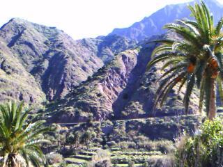
Views from the casa are amazing. Sitting in the window seats we can see the mountains rise to the east. The valley to the north is covered in banana plantations and sweeps down to the sea. Even after nearly six weeks it still seems strange that it is cooler inside than out in traditional buildings. We guess if you worked outside in the sun you went home to relax in the shade.
We decided a day out was in order. The Garajonay National Park here purports to be a rain forest. It is hard to know why but the park information centre is at least 3km outside the park boundary. It is also about as far away from the main tourist routes to the park as it could be. The management reckons it must be the ideal tourist attraction. No one would be there so that is where we went.
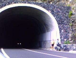
The first part was down through the Hermigua valley almost to the sea. We then started a steady and then a not so steady climb. At first we were climbing diagonally up cliffs parallel to the shore. We then went through a short tunnel before climbing steeply up a valley side inland.
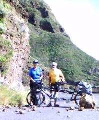
The views all the way up were spectacular and traffic virtually nil. We have become quite blasé at cycling beside vertical drops of hundreds of metres. The management tries to keep away from the edge...most of the time.
Following a lovely picnic lunch we arrived at the visitor centre mid afternoon. The management was right and for much of the time we were the only visitors. We were probably outnumbered by the staff 5 to 1, let alone the inevitable builders adding to it. Perhaps they have not heard that when you have dug yourself into a hole it is best to stop digging. But then we suppose they have our EC money.
As on many occasions the guide book proved to be correct. It said that there was more information than anyone could possibly need. We asked whether the claim that the park was a rain forest was true. That is whether it resembles the vast rain forests in other parts of the world. True to form for visitor attractions we did not get an answer.
One of the more interesting models was one of the Canaries from the ocean bed. It accounted for the extreme cycling in the mountains. The nice quiet foothills are hundreds of metres or more below sea level. We are in the high mountain peaks, the craggy bit at the top. The amazing thing is that we can cycle it at all. So we went down hill to the coast. The views were even more spectacular on the way back though the management is grumbling about brake and wheel rim wear. A 250 metre climb and a carry up the steps got us back to the casa.
One of the nice things about today was that we saw a wild live rabbit. It was the first wild mammal we have seen alive since we have been in the Canaries. From the road kill they do have hedgehogs and rodents but that's it. Pretty boring on that front really.
Days 39 and 40 16th and 17th December in the Hermigua valley, La Gomera
We decided to spend these couple of days exploring our valley. It is about 10km long running from the mountains in the south northwards to the sea. The valley floor is completely green, mainly with banana plantations but there are also vines, potatoes and other vegetables. To the east is a long ridge rising almost sheer to over a 1000 metres. To the west mountains stretch away towards San Sebastian.
It is a great walking area and we decided to take to our feet. Being ill equipped for serious mountain walking we took it easier on minor roads and tracks. We walked down the east side of the valley high above the main road. There was little sign of tourism among the settlements we walked through. Most had the inevitable smoky bar and a cheery hola or buenos dias was common.
Arriving at the floor of the valley we got to the shop just as it had closed. We were rather disconcerted to discover that being Saturday it would not reopen after siesta. We really needed supplies but had to make do with what we had. And the panaderia which opens much longer has nice bread, cakes and icecreams.
Having done the upper east end of the valley on foot we used the tandem so that we could go a bit further. We also now had an urgent need for supplies and it being Sunday wanted to make sure we did not miss the shop.
We left the casa and freewheeled quickly down to the main village. Supplies were got though much to the management's amusement we have living proof that some women can only do one thing at a time. While doing our checkout and talking on the phone our assistant achieved a bill of €463. With much good humour we unpacked the panniers and started again.
Panniers full we headed for the beach. There were a couple of bars and cafés, all shut. The banana plantations come right down to the rocky beach. The waves over the rocks make it unsafe for swimming. Even if this were not the case it would have been foolish. The standard of the drainage here is low and we doubt if the water is tested for bathing.
Having looked at the waves and the one yacht at anchor being badly buffeted by the strong winds we moved on. A false start did take place with the management endeavouring to get through a banana plantation. This proved impossible, much like trying to get through a maize field in Dorset.
We were intrigued by a structure on the point at the far western end of the beach. We went to look and only got there at all by laying the tandem on its side to get under a gate and then proceeding on a very dodgy road. There were fallen rocks on the cliff side and subsidence on the sea side.
Among and on top of the rocks there were four or five huge stone pillars. They resembled bridge supports and were at least 50 metres high. Unless they had EC money to build a bridge to Tenerife they seemed to have no purpose at all.
Funnily enough this area features in much of the tourist junk publications. There was a closed café and a disused marine bathing pool. It could have been rather nice once. Most of the tourism here seems very low key. Many of the people we see are German walkers. The whole beach area and all that goes with it seem very run down.
We enjoyed exploring, and the peace and quiet, before making our slow way up the west side of the valley. The plan was to get back to the casa for a very late lunch and enjoy the last hour or so of the sun. The management has two maps. One is the Spanish equivalent of our OS maps and the other a fairly good tourist map. The first is difficult to read but accurate and the other is a tourist map.
The proper map showed that the road did not go through. The other said it did. We knew it went most of the way because we could see it from the casa window. It did not of course go through. It started with a fine white line in the middle and crash barriers down the side. It ended at a dangerously steep uneven set of narrow steps going down into the valley and up the other side. What was worse was that the road back to the casa was only about 300 metres away as the crow flies.
While the stoker took the usual incriminating photographs the management considered his options. It would be a long, difficult and dangerous job to get the tandem across those 300 metres. On the other hand to turn back would involve a dent to his pride, not to mention considerable friendly chiding from the stoker. She by the way had already found a black line on the tourist map which she claimed indicated it was a dead end.
Had we been 30 km up the road with these options there is not the least doubt that down the steps we would have gone. Danger is the management's responsibility and the stoker's concern. As it was we retraced and all we lost was some time in the sun. Furthermore, the management was not too badly got at as there was no way the stoker was voluntarily going down those steps. And she got lots of great pictures to show our friends.
 |
We went through many unlit tunnels like this one, some of them a kilometre long |
Day 41 18th December Hermigua to Alto de Garajonay and back, La Gomera
An early start was called for but we had definitely left by 10.30am. Having carried the tandem down the steps the only way was up. Being the best road on the island it was well graded and being Gomera there was little traffic. The views were nice and ever changing as we went up gradually in a low gear.
All too soon we reached the junction with the minor road to take us most of the way to the top of the island. Those of us with the courage to look up could see the road almost vertically above us at a dizzy height on the mountain. Had we thought, which we didn't, we would have known that we were going higher than the tops of any of the mountains we could see.
Now often in our lowest gear we began to realise the advantages of travelling light. We only had the essential stuff. That is a premade picnic lunch, just the right amount of water (no tea today), windproof jackets and the minimum of bike stuff. The steering was easier and when a little effort was required it was immediately rewarded with acceleration.
As we got higher on the mountain we began to see all the states of the 'rain forest' we had been told about at the visitor centre. The Hermigua Valley is extremely green and lush for the Canaries but this was quite different, in fact different from anything we have seen anywhere else.
It is clearly not a rain forest like the ones in South America. It is the last remnant of the laurel tree forests which once covered most of southern Europe. There is very little rainfall here but the misty clouds blow in on the trade winds. The trees then get wet and basically drip onto the ground below. The effect is that everything gets covered in a green moss type plant. It also enables things like grasses, firs and even mushrooms to grow.
Cycling up we had lots of time to observe and enjoy the forest. The road was often shaded by trees. These small but densely spaced trees grow on the steep mountain side on both sides of the road. We suppose they could be compared to one of those horrible dark valleys in the lake district where dead and rotting foliage is interspersed with stunted trees. Even though it looks a bit like that it has a totally different feel about it.
We eventually reached the top of the island. There have been no recent volcanic eruptions here and the top is a relatively level plateau at about 1300 metres. From this plateau run a number of huge and spectacular ravines down to the coast, at our speed a long time to explore them all but at least we did our own valley properly.
Once on the plateau we enjoyed lunch in the sun looking down on most of the mountains and the Atlantic ocean. We parked the tandem for the final assault on the summit at just under 1500 metres.
At the summit was a pleasant view point which had almost the feel of a place of worship about it. While we were there maybe a dozen people of several different nationalities came and went. People tended to speak in hushed voices. Some, the management included, took the opportunity to have a siesta in the warm sunshine. This he did in absolute comfort wearing only his cycling shirt and shorts. We have crossed lower passes than this in mid summer in Europe, thrown snowballs and raced to get down into the warmth of the valley. What a contrast this was.
What inspired us and made the place special was the green forest covering every part of the plateau that we could see, unique in our experiences. We have all seen the pine forests of Scotland despoiling the glens and mountains for miles around. This was nothing like that. It is altogether more alive and beautiful and it was worth doing this trip just for that view.
The whole of the rest of the ride was down. It is amazing how much confidence it gives a cyclist to know this. Even though we had only done half the day's kilometres and it was late afternoon we knew we would be back in under an hour. Mind you it is hard work on the brakes and the corners. The management, ever mindful of the stoker's safety, made sure all the mechanical bits were in place before we set off.
Day 42 19th December in Hermigua, La Gomera
Today is a day off. It is a long time since we had one and all the chores needed doing. It also dawned one of nicest days we have had lately. It was no hardship for the management to have his morning shower and dry off in the sun on the biblical style flat roof. The fact that the stoker had washed every item of his limited wardrobe and all of it was wet was unimportant to him.
The stoker walked to the local shops to get supplies and post a parcel home. It took rather a long time. It only takes a few moments down on the tandem and the steady climb back is not too hard. The human body is not nearly so well geared.
The management's duties once his clothes were dry were to pick some oranges from the tree in the garden and check the tandem. The tree has provided us with a large number of fruit all this week but the remainder are now getting too high for him to reach. He has taken to hitting them with the stoker's walking pole and trying to catch them before they hit the ground. With his co-ordination this is a very ineffective method of harvesting.
The other thing we both tried to do is to keep up with correspondence. We had had a worrying message from home about Noah, our youngest grandchild. Some texts put our minds at rest. Even with the magic of modern communications we are still a very long way away and isolated when something goes wrong.
Home Page
The Route
Week 1
Week 2
Week 3
Week 4
Week 5
Week 6
Week 7
Week 8
Week 9
Week 10
Tandem by Air
Bike and Gear
Navigation and the GPS
Stoker's leg
Links+Downloads
This site is created and maintained by Anne Neale and Ken Reed.


