The files are in .zip format. They need to be unzipped and saved to a directory of your choice. You can then load them into the appropriate application and GPS.
The Blog
St Quay Portrieux to Les Sables dOr Les Pins
Saturday 30th April 2011
This was one of the nicest rides we have had on this tour, made all the better because we had not expected it to be anything special. We were to transverse Saint-Brieuc, the largest city on our route. Even the wonderful weather we had had was gone and as we rolled out it was misty and grey.
The management had carefully planned a route out of St Quay Portrieux to avoid the traffic on the main roads. We soon abandoned this once we realised that there was very little traffic except on the main coast road.
We made our way through pretty villages separated by fields and woods. Every so often we descended to the seaside. As we made our meandering way the weather also gradually improved and we had the occasional glimpse of the sun.
Those who dont understand cycle touring will not understand the pleasure and satisfaction to be gained from transversing a large town via the quiet back streets. All human life is here and to be enjoyed.
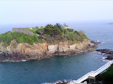
From our hotel at St Quay Portrieux
We skirted Plerin on the outskirts of St Brieuc via the superstore area. Fortunately and unlike, for example, Ivybridge in Devon the planners had not blocked our through route. A little further on we had a view to our right of the massive modern concrete road bridge which takes all the traffic into St Brieuc.
From here we had a steep descent to the dock area of St Brieuc, now mainly a yacht harbour and very nicely understated. Our river crossing, the lowest point before the sea, was over a narrow swing bridge surfaced in wood. We then had the inevitable climb out of the river valley.
At the top of the climb, rather than find ourselves in the usual heaving pollution of a city centre, we were in a local village centre. It was for once complete with café, boulangerie and fruit and vegetable shops. We took advantage of these to buy our picnic lunch.
From here we were soon back out in the countryside following near the now disused railway line east before heading north again towards our destination.
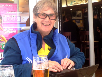
Lost in a bar in Plénuef-Val-André
We spent the afternoon cycling through tiny lanes beside the polders of the seashore and then farmland and hamlets. We even came across a château, now a hotel, and a river ford to challenge us.
It was quite a shock for the management to find that our hotel was not located at the end of his GPS route. The stoker pointed out that this was not surprising as the hotel was at Les Sables dOr les Pins and we were at Plénuef-Val-André, 15km away.
It took a couple of beers in a pleasant bar for the management to adjust to his error. We put Nannys battery on charge and unpacked the computer. We let MapSource devise a route to the hotel with its bicycle options which was then downloaded to the GPS. With us and the battery charged we continued on our way.
The computer came up trumps. The route avoided all avoidable main roads and took us via some very pleasant cycle paths (number V22 we think). If only the powers that be on both sides of the channel would sign cycle path destinations. This is hardly ever done and often spoils the ship for a hapeth of tar.
We arrived at the hotel soon after 6pm having had another great ride.