

History
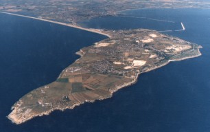
The route of the Chain Gang Trail is steeped in history, some of which is mentioned below. Portland Harbour, even before the construction of the breakwater in the 1890s, was a superb natural anchorage and port. Perhaps because of this and its high quality stone Portland has been prosperous since Roman times. Its history is fascinating. It ranges from the remains of the Roman occupation to the history of stone quarrying.
Islanders, staunchly independent to this day, were smugglers and wreckers but also fishermen, farmers and prison guards. Not to be missed are the graves of those who died fighting off illegal press gangs, and there are salacious stories of free love and trial marriages. It is all there for followers of the Chain Gang Trail to enjoy at their leisure.
The first part of the route is beside the Weymouth backwater, now a bird sanctuary on land reclaimed as the town expanded in the 18th and 19th Centuries. For seven km it follows the route of the Weymouth and Portland Railway line, part of which is now the Rodwell Trail. This line was opened as far as Victoria Square in 1865 and subsequently extended to the top Tophill of Portland via a spectacular route along the east cliffs of the island. The line carried armaments and troops as well as Portland Stone and was an important passenger link for Islanders. It closed to passengers in 1952, freight in 1965 and the tracks were removed in 1970.
To railway archaeologists it is an exceptional route because, unlike most urban lines, the track bed has not been lost to development. It also retains much of interest including several platforms and an impressive tunnel. It contributed significantly to the war effort during both world wars. Near the beginning of the trail are the remains of an impressive anti-aircraft site. At Ferry Bridge, near to the memorial stone marking the location of the now demolished Whitehead's torpedo factory, are the remains of substantial military works. Not only did these enable the loading and transfer of freight but they provided access to Portland if the road bridge were bombed. The route also passes within 300 metres of Sandsfoot Castle which also saw action but during the Civil War.
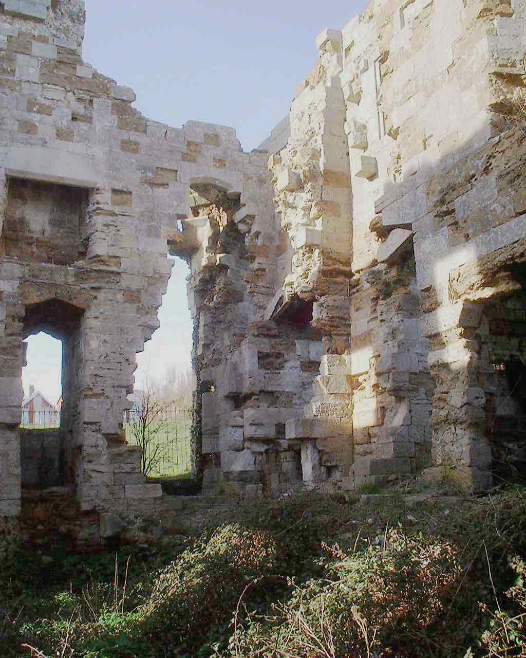
Sandsfoot Castle, a romantic ruin
After crossing the new bridge over the Fleet, on the right is a large car park which is now home to the RSPB. The locals call this the American car park. Prior to the D Day landings in June 1944 this was where the massive preparations for the invasion fleet were made. Soon the route passes through the old naval base at Osprey Quay, now the National Sailing Academy. On your left you will see two pieces of the Mulberry Harbour which never made it to Arromanches on the Normandy landing beaches in France.
Once in Castletown on Portland the only way is up and the route follows the incline and track ways of the Merchant Railway. For a short distance cyclists will be encouraged to walk. This is both because of the steepness of the incline and to ensure that the archaeology, including stone sleepers, is not damaged. The purpose of the merchant railway was to transport stone from the top of Portland to the docks. The remains of an impressive network of tracks, bridges and earthworks are the backdrop to the Trail. Stone was lowered to the docks down the incline by the use of counter balances and brakes. There are stories of accidents and runaways to go on the information boards.
On the top of Portland the earthworks of the enormous nineteenth century fortifications at the Verne, now a prison, are passed. Soon after this are the remains of high level batteries and other fortifications. From here it is only a short level detour of 500 metres to Tout Quarry, a worked out stone quarry now an impressive sculpture park. The trail itself passes Nicodemus Knob, a tower of rock which indicates the level of the land before quarrying took place. Much of the stone was used to construct famous buildings in London including St Pauls Cathedral.
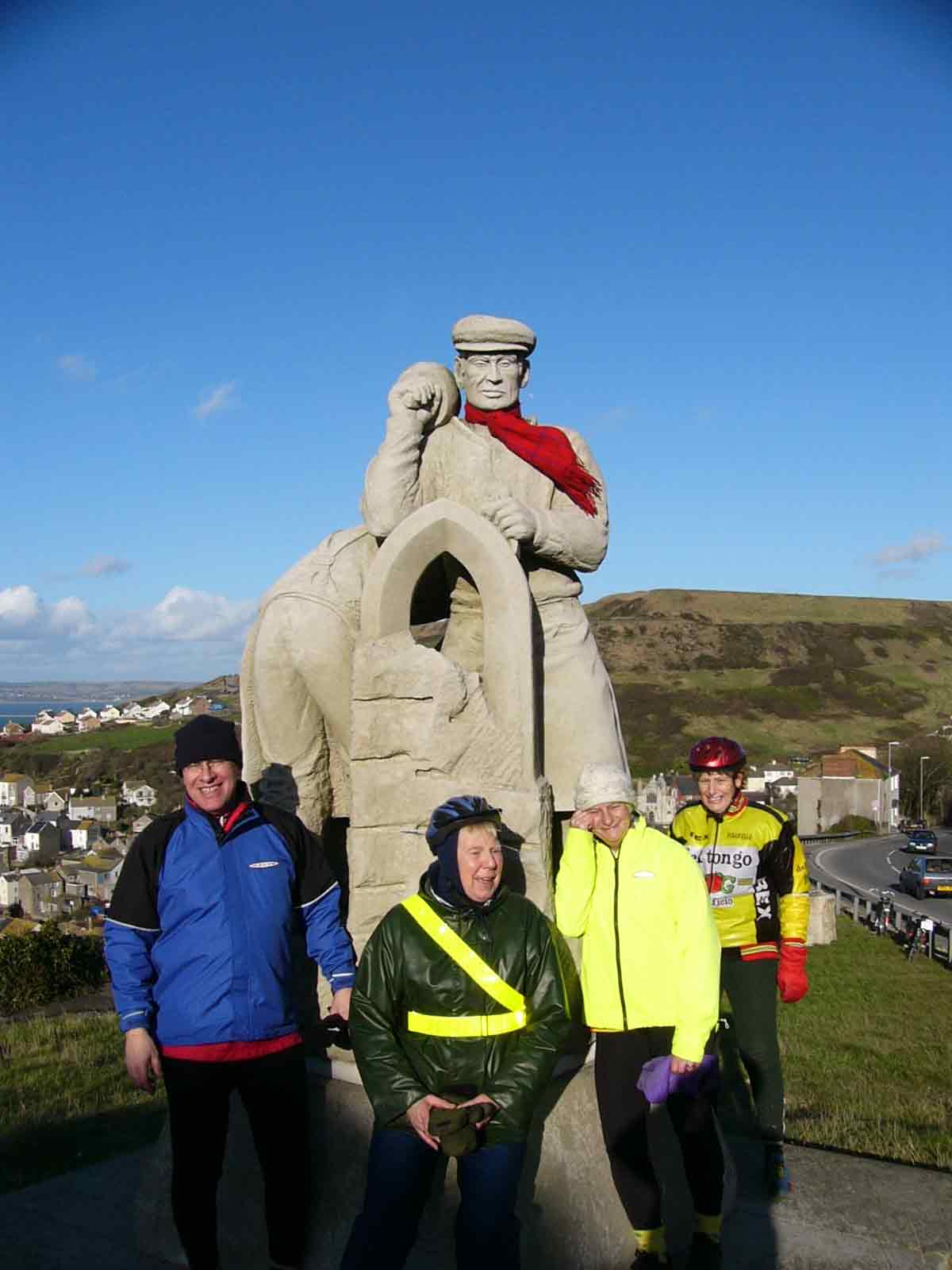
The Spirit of Portland statue says it all
After crossing the new bridge over the Fleet, on the right is a large car park which is now home to the RSPB. The locals call this the American car park. Prior to the D Day landings in June 1944 this was where the massive preparations for the invasion fleet were made. Soon the route passes through the old naval base at Osprey Quay, now the National Sailing Academy. On your left you will see two pieces of the Mulberry Harbour which never made it to Arromanches on the Normandy landing beaches in France.
Once in Castletown on Portland the only way is up and the route follows the incline and track ways of the Merchant Railway. For a short distance cyclists will be encouraged to walk. This is both because of the steepness of the incline and to ensure that the archaeology, including stone sleepers, is not damaged. The purpose of the merchant railway was to transport stone from the top of Portland to the docks. The remains of an impressive network of tracks, bridges and earthworks are the backdrop to the Trail. Stone was lowered to the docks down the incline by the use of counter balances and brakes. There are stories of accidents and runaways to go on the information boards.
On the top of Portland the earthworks of the enormous nineteenth century fortifications at the Verne, now a prison, are passed. Soon after this are the remains of high level batteries and other fortifications. From here it is only a short level detour of 500 metres to Tout Quarry, a worked out stone quarry now an impressive sculpture park. The trail itself passes Nicodemus Knob, a tower of rock which indicates the level of the land before quarrying took place. Much of the stone was used to construct famous buildings in London including St Pauls Cathedral.
Windmill with sails long gone
Next we come to the Grove which has been a harsh prison for many generations. Prisoners were brought here and worked in Chain Gangs under armed guards. Their first task was to hew stone and to construct their own prison. They also built St Peters, a spectacular church with beautiful interior mosaics constructed by a convicted murderess. It is hoped that the money visitors on the trail will bring will help to avoid this church from falling into disrepair.
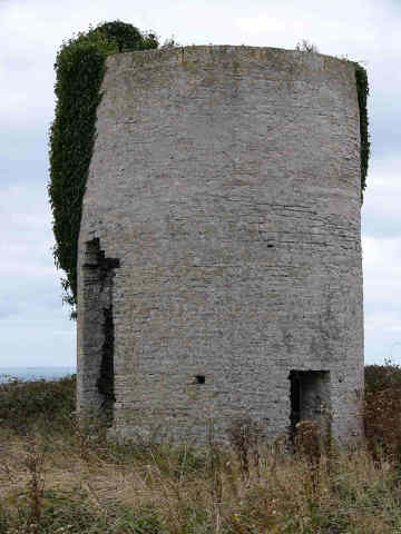
Soon after passing through Easton the remains of an earlier era will be seen in the old railhead and the headquarters of quarrying. Two much neglected windmills, their sails long gone but ripe for renovation, are passed. In Weston, just before gaining the west coast, is Gypsy Lane, a beautiful Dorset backwater reminding one of a rural idyll.
On the gentle descent to the Bill you will first pass the austere buildings of the Southwell Business Park. This is now a thriving place but was perhaps once something much more sinister. We can only guess why the Government of the day needed premises in such a remote and lovely place, but we can speculate as do the locals.
As we get nearer to the Bill the three lighthouses, each of a different era, soon dominate the landscape. And the fields which we have passed through can show, to the trained eye, signs of habitation and cultivation going back to Roman times.
Our Sponsors and helpers: