The route is in blue
Weymouth to Abbotsbury and back
This is one of the best short rides in the West Country and all on tarmac though some short distances are rather rough. It is suitable for all types of bike including loaded touring bikes, tandems, trikes and bikes with child trailers.
It offers superb views of the Fleet and Chesil Beach before arriving at the picturesque village of Abbotsbury with its Swannery, St Catherine’s Chapel and several cafés and pubs. There is a stiff climb out of Abbotsbury giving panoramic views of Lyme Bay, Portland, Weymouth and beyond.
 |
Fleet old church |
The route starts from the Weymouth Swannery car park and once you reach Fleet Lane it suddenly becomes rural Dorset. After passing the popular camp site and at the bottom of the next hill on the left you can visit the old Fleet Church. This tiny church was immortalised by J. Meade Falkner in his novel “Moonfleet”.
Just before you reach the village of Langton Herring you have to do about half a mile on the busy B3157 coast road. This is best done quickly and is not really safe for children on solos. There is a bridle path which avoids this short stretch but it is rough, hilly and a long diversion.
Just before the hamlet of Rodden one of the local farms hosts a Maize Maze in the summer. You will need three hours to do it properly.
You will find the Abbotsbury Swannery on the left just before you reach the village. A visit here can take at least a couple of hours. Leaving Abbotsbury refreshed there is a very long steep climb up Lime Kiln Lane. Most of us walk this, not just because it is steep but also to enjoy the superb views which change and extend as you reach the top of the hill.
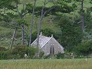
Portesham is another pleasant village with a pub and a shop. Just after the hamlet of Coryates there is a tiny chapel at Corton Farm on the right (SY63682 85569), not to be missed.
At Upwey you will need to be hard pressed to pass the Wishing Well café which is often frequented by local cyclists.
Part of the route into Weymouth is on the busy Dorchester road. For children or the less experienced it is of course illegal to ride on the pavement but a lot safer.
Downloads for this route
The following files are in .zip format. They need to be unzipped and saved to a directory of your choice. You can then load them into the appropriate application.
This route in Google Earth format to open in the Google Earth application
This route in Garmin format version 2 for uploading to your GPS
This route in Memory-Map format, waypoints only, for uploading to computer's software
This route in universal format for uploading to many applications
This is the the route in .kml format
This is the the route in .gdb format
This is the the route in .mxf format
This is the the route in .gpx format