The route is in blue:
Upwey to Ferrybridge
The route starts at the Wishing Well café at Upwey to the north of Weymouth. Those staying in Ferry Bridge, Wyke, Chickerell, Nottington or Upwey will find it a convenient way to travel between these villages. Those travelling between Upwey and Ferry Bridge may find it easier to travel into Weymouth and out again.
It is suitable for all types of rider including children. It is also suitable for most types of bike. Those on trikes, trailers and heavily laden tandems may need to take a short diversion but otherwise should also be able to enjoy this route. There are two short stretches on the busier roads, one of which is on a very steep hill. For children or the less experienced it is of course illegal to ride on the pavement but a lot safer.
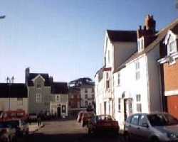 |
The square at Wyke |
The Wishing Well café is often frequented by local cyclists. It has a pleasant garden and the famous wishing well near to the source of the River Wey. If you have time it is worth exploring the Wey valley with its fast running stream and abundance of wild life.
From the Wishing Well you follow the stream of the River Wey south to Mill Lane. There is an abundance of wild life here and little egrets can often be seen. The route turns hard left by the river and joins Dorchester Road. On old maps the river here is shown as a ford though we do not recommend you using it as such.
You need to turn right onto Dorchester Road and right off it again after 200 metres near the light controlled crossing. Many cyclists stay to the west of the road on the pavement for this short stretch. It can also be avoided entirely by those on solos. You turn right onto the signed footpath which crosses the river just before the hard left turn at the ford. This path is very narrow but short and rejoins the route after about a 300 metre walk.
The road soon becomes track and then a bridleway across farm land. It can be wet and muddy in bad weather and is sometimes used by farm vehicles and horses. The only detour is on Dorchester Road south and right into Nottington Lane to rejoin the route at Nottington.
From Nottington to Chickerell you are on minor roads through farms which only become busy at commuting times. After Chickerell you cross the newly constructed £6m Granby Way which is often deserted.
After a short stretch on residential roads you join the B3157 which can be busy. At Five Ways Corner traffic lights you turn right and soon climb the very steep Lanehouse Rocks Hill. There is no alternative for this section of the route, not even on footpaths. Less experienced cyclists and children may prefer to take to the pavements for all or part of this section of the route.
Soon after you reach the top of the hill with its panoramic views of Chesil Beach, the Fleet, Portland, Weymouth and the Jurassic Coast you turn right onto residential roads. From here you quickly descend to Ferry Bridge.
Downloads for this route
The following files are in .zip format. They need to be unzipped and saved to a directory of your choice. You can then load them into the appropriate application.
This route in Google Earth format to open in the Google Earth application
This route in Garmin format version 2 for uploading to your GPS
This route in Memory-Map format, waypoints only, for uploading to computer's software
This route in universal format for uploading to many applications
Copyright © 2009 Ken Reed and Anne Neale
This is the the route in .kml format
This is the the route in .gdb format
This is the the route in .mxf format
This is the the route in .gpx format